![]()
Serving United Arab Emirates KSA Oman & GCC
|
|

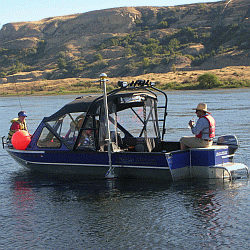
Ard Geographics provide high quality Hydrographic survey information for marine related tasks, covering ports, harbors, rivers and coastal areas. Our Hydrographic Survey Division uses a ‘Hydroskan System’, which combines differential GPS equipment with high precision digital echo sounders, to produce hydrographic data that can be seamlessly merged with topographic data for 3D model creation. All digital data from the surveys is presented as standard charts or digital drawings. Volumetric analysis and cross sectional representation is readily available. The data may also be input to a GIS database thus allowing for future studies to be conducted with greater efficiency. Applications
Deliverables
|

| |
|
Ard Geographics - F.Z.C. Hotline: 971-50-5452727 |

© Copyright Ard Geographics, 2001-2021. All Rights Reserved. |